
Key Highlights
Navigating the city of Santiago de Chile is simple with its advanced public transport. Here’s what you need to know about the Santiago Metro and its integration with other transit options.
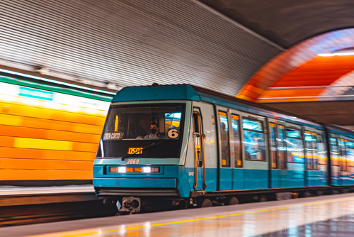
- The Metro de Santiago is a massive underground system, spanning over 140 kilometers with 136 stations across seven lines.
- Unlike the heavy-rail metro network, a light rail line generally features smaller trains and may operate at street level.
- The metro system is continuously growing, with a recent extension of Line 3 and plans for a new Line 7, 8, and 9.
- Recent expansions significantly cut travel times, with the Line 3 extension reducing some journeys by 55%.
- Future projects aim to connect more communes like Renca and Cerro Navia to the metro for the first time.
Understanding Santiago’s Metro and Light Rail Systems
Welcome to the public transport system of Santiago! The heart of the city’s mobility is the Santiago Metro, a state-of-the-art subway that is one of the most modern in Latin America. This extensive metro system connects millions of residents across the city of Santiago, making it an essential part of daily life.
While the Metro de Santiago is a heavy-rail rapid transit system, it’s helpful to understand how it differs from a light rail line. Exploring these differences can give you a clearer picture of the city’s comprehensive public transportation network. Let’s look at the specific characteristics that set these two transit types apart.
Overview: Metro vs. Light Rail – Key Differences
When traveling through Santiago, you’ll primarily use its impressive metro system. But what separates a metro from a light rail? The main distinction lies in capacity, infrastructure, and operation. Santiago’s network is a heavy-rail rapid transit system, designed for high-capacity, high-speed travel, mostly underground.
In contrast, light rail systems typically operate with lighter rolling stock and may run on tracks at street level, sharing space with other traffic, although they can also have dedicated rights-of-way. They often serve as feeders to a larger metro network or cover areas with lower passenger density.
Key differences to keep in mind include:
- Capacity: Metro trains, like the Alstom Metropolis models for Line 7, can carry over 1,200 passengers, far more than typical light rail vehicles.
- Infrastructure: The metro runs on a dedicated, grade-separated concrete trackbed, while light rail can be more flexible.
- Speed: As a rapid transit system, the metro operates at higher speeds over longer distances compared to most light rail lines.
Current Status of Metro and Light Rail Services in Santiago
Currently, the public transit landscape in Santiago de Chile is dominated by the extensive Metro de Santiago. While there are discussions and plans for various transit solutions in Latin America, there is no separate light rail system operating in Santiago today. Your travel within the city will rely on the metro rail and its connecting bus lines.
The focus remains firmly on expanding the existing metro. The construction of line after line has transformed the city over decades, and this momentum continues with several ambitious projects underway. These expansions are set to dramatically improve connectivity from the city centre to outlying communes, reinforcing the metro’s role as the backbone of urban mobility.
Recent and future expansions illustrate this commitment:
| Project | Status/Completion | Key Benefit |
|---|---|---|
| Line 2 Extension | Opened Nov. 2023 | Reduced travel time by 42% for 32,000 daily passengers. |
| Line 3 Extension | Opened Sep. 2023 | Cut journey time by 55% for 271,000 residents. |
| Line 6 Extension | Completion by 2027 | Will reduce travel time by 87% for 90,000 residents. |
| Line 7 | Operational by 2028 | New 26km line connecting Renca, Cerro Navia, and Vitacura. |
How Does the Light Rail System in Santiago Compare to Pittsburgh’s “T” System?
The Santiago light rail system boasts modern trains and extensive connectivity, making it a vital part of the city’s transport. In contrast, the pittsburgh light rail system, although smaller, offers a reliable alternative for commuters. Both systems emphasize accessibility but differ in scale and urban integration.
Main Routes and Features of the Santiago Metro Network
The Santiago Metro network is the primary artery of public transportation in the capital, featuring seven lines that crisscross the metropolitan area. Since its first line opened in 1975, the Metro de Santiago has grown into a 140km system with 136 stations, with more new stations on the way. Its modern trains and clean stations make it a reliable choice for getting around.
This well-designed network connects key residential, commercial, and cultural hubs throughout Santiago de Chile, ensuring you can reach almost any destination with ease. The following sections will guide you through the major lines and show you how the metro connects with other transit options for a seamless journey.
Major Metro Lines and Stations
The core of the metro network was originally formed by Lines 1 and 2, creating a “T” shape that connects the city. Line 1 runs east-west, while Line 2 provides north-south service, intersecting at Los Héroes station near the city center. This simple layout makes navigating the central districts straightforward for newcomers.
Over the years, the metro system has expanded dramatically. For instance, Line 5 branches off from Line 1 at Baquedano and heads south, while Line 4 provides a crucial route through the southeastern districts to Plaza de Puente Alto. The network continues to grow with each new line, reaching further into different municipalities.
Key stations serve as major hubs and terminuses. The eastward extension of Line 1 added important stops like Hernando de Magallanes, while Line 3 connected the municipality of Quilicura to La Reina. Future lines will continue this pattern, integrating even more of the metropolitan area into the fast and efficient metro network.
Notable Connectivity with Light Rail and Other Transit Options
A major strength of the Metro de Santiago is its seamless connection with other forms of public transport. While there is no current light rail to connect with, the metro is fully integrated with the city’s extensive network of bus lines. This integration was a cornerstone of the ambitious Transantiago project, designed to create a unified public transport system.
This means you can easily transfer from a metro rail station to a bus to complete your journey. The system is designed to make these transfers smooth, with many stations serving as intermodal hubs where bus lines and metro routes converge. Stations like Franklin and Vespucio Norte are prime examples of these busy connection points.
The integration offers several benefits for commuters:
- Unified Payment: You can use a single card for both the metro and buses.
- Wider Reach: The combined network covers nearly every corner of the city.
- Convenience: Intermodal stations simplify transfers between different transit modes.
- Efficiency: Coordinated routes help reduce overall travel time across the city.
Frequently Asked Questions
Are there plans to expand Santiago’s Metro or Light Rail networks?
Yes, absolutely! The Santiago Metro is in a constant state of growth. Major projects include the construction of Line 7, Line 8, and Line 9, which will add dozens of new stations and kilometers to the network. Additionally, a 3km extension of Line 6 is scheduled for completion in 2027.
How do tourists and locals use tickets and passes for public transit in Santiago?
To use public transport in Santiago, you’ll need a “Bip!” card. This reloadable smartcard is used for both the metro and buses. You can purchase and add funds to the card at any metro station. There are no separate tickets or special tourist passes; everyone uses the Bip! card for convenient travel.
What is the best way to navigate Santiago’s transit network during peak hours?
The Santiago Metro gets extremely crowded during peak hours, roughly 7-9 a.m. and 6-8 p.m. To navigate the rush hour crowds, try to stand where the end of the train will stop, as it’s often less packed. If possible, traveling during off-peak hours is the best way to ensure a more comfortable journey.