Key Highlights
- A ZIP Code stands for Zone Improvement Plan. It is a 5-digit number that shows groups of mailing addresses in the United States.
- The ZIP Code system was created by the United States Postal Service (USPS) to make mail delivery better and quicker.
- A ZIP Code is made up of a main area, a city or region, and specific spots for delivery.
- ZIP+4 codes add four extra digits to the basic 5-digit code. This helps with more exact mail delivery.
- ZIP Codes are very important for things like data analysis, studying demographics, and planning marketing activities.
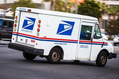
ZIP Codes are a type of postal code used in the United States. They are important for the postal service system. Created by the USPS, these 5-digit codes make mail delivery easier across geographical areas. This helps ensure that mail reaches the right places quickly and accurately. ZIP Codes group addresses into specific postal zones, which allows mail carriers to find locations faster. This saves time and helps use resources better. Over time, the system has improved. It now includes the ZIP+4 format, which makes it even easier to find delivery spots.
Understanding ZIP Codes
ZIP Codes are more than just numbers on your letters. They play a key role in the mail system in the United States. They help make sure mail goes to the right place. USPS created ZIP Codes to make sorting millions of addresses across the country better.
ZIP Codes do more than just aid in mail delivery. They assist in several other areas, such as statistical analysis, community understanding, and verifying credit card information. Their special and structured format makes mailing and data systems more accurate.
Definition and Purpose
The term ZIP means “Zone Improvement Plan.” This shows that the main purpose is to make mail sorting and delivery better across the country. Each ZIP Code points to a certain geographic area or a group of addresses. This is very important in the postal code system.
ZIP Codes started to help sort and deliver mail more quickly in various postal zones. The United States Postal Service (USPS) uses a number system. This system makes it easier to move mail from processing centers to homes and businesses. It saves time and helps lower mistakes in mail delivery.
ZIP Codes are not just for sending mail. They provide important details for understanding trends in different populations, exploring market possibilities, and aiding local governments in making choices. Whether in a busy city or a quiet rural area, ZIP Codes play a key role in how we organize maps and locations.
Evolution from Postal Zones to ZIP Codes
Before ZIP Codes were introduced, the USPS used postal zones to send mail in large cities. This old method was effective but often led to delays and issues. To solve these problems, the USPS began using the ZIP Code system in 1963.
This change was a great improvement. The zip code system split the country into 10 postal zones. It started with “0” for the Northeast and finished with “9” for the West. This created a clear and organized structure. Areas were divided further to identify specific routes.
People saw right away that ZIP Codes were simple and useful. They made the postal service faster and easier to trust. Over time, new tools were introduced, like the ZIP+4 system. This made deliveries even more accurate, moving the ZIP Code system into today’s logistics world.
How ZIP Codes are Structured
ZIP Codes make it easier to deliver mail. Each 5-digit code is connected to a specific area. This can be a small town or a large city.
They also display national areas, regional parts, and local delivery neighborhoods. The layout provides clear guidance. Even a single digit shares important location details. There are also more specific options like the ZIP+4 system, which improves the entire system.
The Basic 5-Digit Format Explained
The first digit of a ZIP Code represents one of ten national postal zones in the United States. It goes from the Northeast, which is 0, to the West, which is 9. This digit indicates the general geographic area that the ZIP Code includes.
The next two numbers show a sectional center facility (SCF) or a big city that acts as the mail sorting center in that area. For example, in the ZIP Code 47722, “77” stands for Vanderburgh County, Indiana. These centers make sorting the mail easier.
The last two digits point to certain ZIP Code areas, such as a neighborhood or some addresses. Together, this 5-digit format creates a simple system that helps identify specific delivery locations for mail. This makes postal work run smoothly and efficiently.
Additional 4 Digits – ZIP+4 System
The ZIP+4 system adds four extra numbers to the regular 5-digit ZIP Code. This new format helps find exact delivery locations, such as a specific building, floor, or post office box. For example, “12345-6789” gives clear details for the delivery process.
These extra digits connect to ZIP Code tabulation areas (ZCTAs). ZCTAs are smaller parts of land. This information helps postal workers find hard-to-reach delivery spots. It makes services for homes and businesses more accurate.
Using ZIP+4 codes is not required, but they can make the postal service much more accurate. This is very important when sending a lot of mail. It is also crucial for items that must be delivered exactly, like invoices or legal papers.
Administrative Role of ZIP Codes
ZIP Codes are not just for sending mail. They are important for local government and city planning too. Each code connects to specific delivery routes. This connection helps services to work within their actual areas.
Government agencies use ZIP Codes often for their planning and coordination. They help organize and understand different regions, especially for things like taxes and voting maps. Let’s look at how ZIP Codes influence city operations and local government.
Aligning with Municipal Boundaries
ZIP Codes do not always stick to city or town lines, but they help link services in these areas. Postal code systems are designed for shipping. They can cross state or region borders, unlike cities or counties.
Government agencies use ZIP Codes in different ways. They are used for census counts and emergency services. One ZIP Code can include several towns. This practice helps them share information more widely.
In rural places, ZIP Codes might extend past town lines. This helps make mail delivery routes more efficient. Even though there is overlap, these lines assist government agencies in providing services more accurately to certain areas.
Impact on Local Governance
ZIP Codes are important for local government. They help to organize demographic data about the community. This information helps officials plan better. It also allows them to use resources where they are needed the most.
The postal code system provides useful information for city development projects. Data from ZIP Codes assists with zoning, arranging voting districts, and preparing emergency plans. Leaders use this data to make important improvements.
ZIP Codes connect government actions to what the community really needs. They help balance planning and offering good services.
ZIP Codes in Everyday Use
ZIP Codes do more than just help with mail delivery. They also determine where services can be found and assist in promoting different areas. This helps improve services based on location. When you shop online or enter your credit card information, ZIP Codes are important details.
They make daily life easier by connecting utilities and public services to your location. Besides helping with mail delivery, it’s important to understand how they impact businesses and the speed of mail delivery.
Importance in Mail Delivery Efficiency
The main goal of ZIP Codes is to speed up mail delivery. Each code is linked to a specific post office. This makes it easier for mail to move quickly through the USPS network.
With ZIP Codes, mail carriers can organize mail by their routes more easily. This cuts down on errors and speeds up delivery.
In large sorting centers, ZIP Codes help machines know where to send mail. They are important for getting mail to the right place, whether it’s a city address or a rural P.O. box. Without ZIP Codes, mail services would not be as accurate.
Role in Service Availability and Marketing
ZIP Codes play a key role in showing where services are offered. Internet companies, gas stations, and delivery services use ZIP Codes to clearly outline their service areas.
For businesses, checking sales data by ZIP Code helps them make better ads. Understanding how people buy in different areas allows companies to design marketing plans that meet local needs.
ZIP Codes provide important details for marketers, from food delivery apps to local event sponsors. They help link products to the right customers. This connection leads to better engagement and happier people.
Technical Aspects of ZIP Codes
ZIP Codes are more than just numbers. They play a role in many technical systems, like mapping and geography. Their organization helps make data more accurate and extensive.
When we examine more than just the basic structure and focus on details, like the differences in Canada, we notice how flexible the ZIP Code system can really be.
Data Precision and Geographic Coverage
ZIP Codes give precise information by pinpointing even the smallest census blocks. They include areas that assist in public planning and business logistics.
These codes help businesses and government leaders sort areas. This makes it clearer and easier to plan for retail growth or school zoning using ZIP Code boundaries.
This accuracy makes mapping better not just for mail, but for important services like health care and schools. ZIP Codes help manage resources more effectively across many addresses in the U.S.
Variations Across Different Regions in Canada
Canada’s postal code system is like ZIP Codes, but there are some differences. It combines both letters and numbers. We refer to them as “postal codes.”
| Aspect | U.S. ZIP Codes | Canadian Postal Codes |
|---|---|---|
| Format | Numeric (e.g., 12345) | Alphanumeric (e.g., K1A 0B1) |
| Geographic Coverage | Bigger area groups | More detailed focus |
| Use Cases | Mapping, finding info about people | Credit card billing addresses, shipping |
When you use Canadian credit cards, make sure to provide a billing address that has the correct postal code. This will help with smooth transactions. It’s especially important when using systems that rely on ZIP Codes.
Frequently Asked Questions
How do I find a ZIP Code for a specific address in Canada?
To find a ZIP Code or postal code for an address in Canada, you can look at online postal code maps. You can also visit your local postal service’s website. Just type in the address to get the code you need.
Are ZIP Codes the same as postal codes in Canada?
No, ZIP Codes are unique to the U.S. and are not the same as Canada’s postal codes. Canadian postal codes have a mix of letters and numbers. In contrast, ZIP Codes only use numbers. Both help us identify addresses for billing and mail.
Can a ZIP Code determine the tax rates applicable to an area?
ZIP Codes do impact how tax rates are determined, but they are not the only thing that matters. Tax rates depend on local rules and the policies of the geographic area. The postal code system helps to distribute resources correctly and make precise calculations.